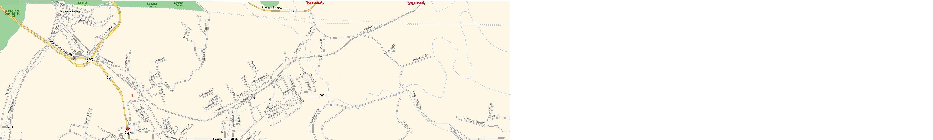
Map Of Harrogate
Map of the City
1. Cumberland Gap Tunnel
2. Harrogate City Hall moved to 138 Harrogate Crossing Near H Y Livesay School, Hwy 63 W
3. Harrogate Book Station is located on Bristol Road at the Old Shawanee Depot (Lower Level).
4. Ellen Myers School
5. Lincoln Memorial University/Abraham Lincoln Museum
6. J. Frank White Academy
7. Tex Turner Arena
8. Harrogate City Park
9. Livesay Middle School
10. Tri State Health and Rehabilitation Center
11. Arthur-Shawanee Utility District (Water Company)
12. Harrogate Volunteer Fire Department (Station 2) The new Fire Hall is now located at 132 Harrogate Crossing near H Y Livesay School, Hwy 63W
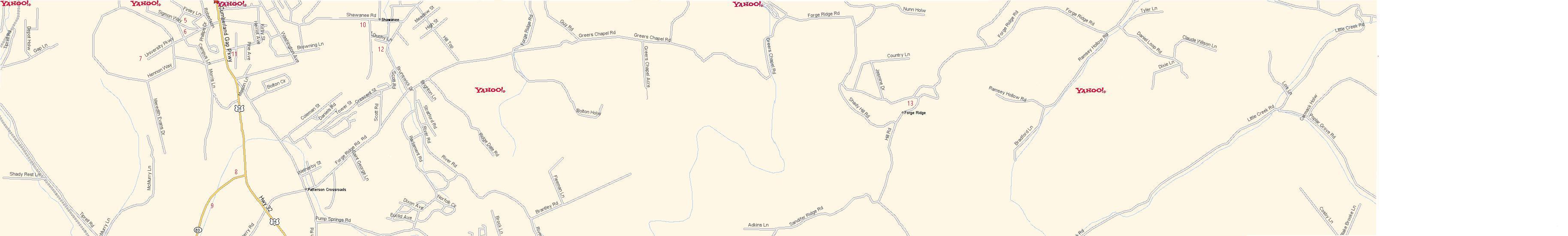
13. Forge Ridge Consolidated School
14. Cumberland Gap High School
15. Tennessee Department of Transportation
Claiborne County EMS NORTH is located at 144 Harrogate Crossing near H Y Livesay School, Hwy 63W
HARROGATE CROSSING IS A NEW STREET NOT ON THE MAP CONSTRUCTED WITH THE BUILDING OF THE CITY'S EMERGENCY SERVICES BUILDING JUST OFF HWY 63 W NEAR THE H Y LIVESAY MIDDLE SCHOOL.